1 min read
Key Points:
- Google has integrated its Gemini AI model with Google Earth, creating a new "Earth AI" platform built on a model called "AlphaEarth Foundations."
- The system converts terabytes of raw satellite imagery into queryable, historical data layers to track environmental changes like sea levels, pollution, and surface temperatures.
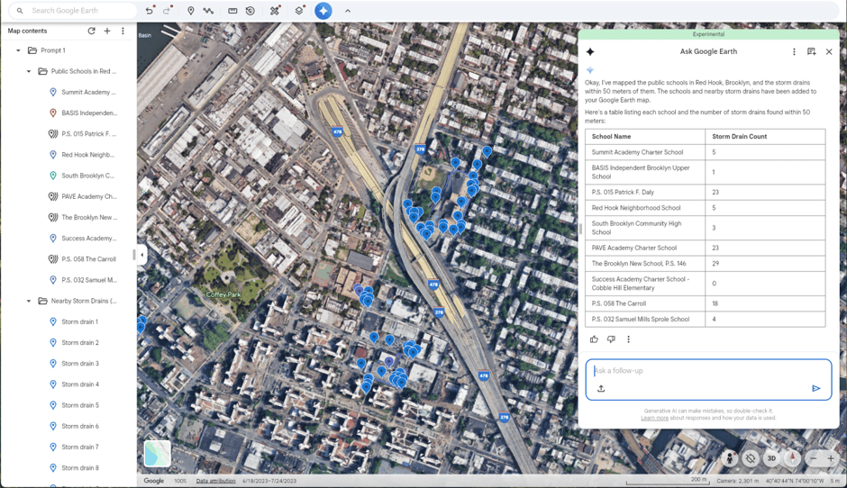
- The key update is a natural language interface, allowing users to ask chatbot-style questions (e.g., "Find algae blooms") that cross-reference imagery, weather, and population data.
- The platform is explicitly designed for forecasting disaster impacts and identifying at-risk communities, and is being sold via new 'Professional' subscription tiers.
Why It Matters:
This moves geospatial intelligence from a deeply specialised, analyst-only tool to a business-level analytical dashboard. For the first time, executives in the public sector (disaster planning), finance (asset risk), or PE (portfolio climate exposure) can directly query real-world physical risk.
Our perspective:
The real story here is the "agent-ification" of a massive, unstructured dataset (satellite photos). This is a blueprint for any industry sitting on huge visual or sensor datasets. The question for clients is: What is your "Google Earth"—your massive, untapped data library—and when will you build the interface that lets your team finally ask it questions?
Source:
https://research.google/blog/google-earth-ai-unlocking-geospatial-insights-with-foundation-models-and-cross-modal-reasoning/